RadarScope vs Zoom Earth
Which is better in 2026? Five scores, side by side.
It's close: RadarScope edges it 8.7 to 8.6, so the right pick depends on what you need. RadarScope wins on 3 of the 5 scores, Zoom Earth on 2.
Storm spotters, chasers and weather enthusiasts who read raw radar
Anyone in hurricane country or who loves watching weather from above
Score by score
The details
| Feature | RadarScope | Zoom Earth |
|---|---|---|
| Category | Weather | Weather |
| Category rank | #4 of 7 | #6 of 7 |
| Developer | DTN | Neave Interactive |
| Pricing | Paid | Free + paid plans |
| Usable for free | No | Yes |
| iPhone & iPad | ✓ | ✓ |
| Android | ✓ | ✓ |
| Mac | ✓ | — |
| Web | — | ✓ |
Common questions
Is RadarScope better than Zoom Earth?
It's close: RadarScope edges it 8.7 to 8.6, so the right pick depends on what you need. RadarScope wins on 3 of the 5 scores, Zoom Earth on 2.
Which is cheaper, RadarScope or Zoom Earth?
RadarScope: $9.99 upfront; optional Pro Tier subscriptions add lightning, archives and models. Zoom Earth: Free with ads; Zoom Earth Pro removes ads and adds 10-day maps and alerts. On value for money, Zoom Earth scores higher.
Do RadarScope and Zoom Earth work on the same devices?
Only RadarScope runs on Mac. Only Zoom Earth runs on Web.
Which is more private, RadarScope or Zoom Earth?
RadarScope scores higher on privacy (9.6/10). App Store label: Data Not Collected. Google Play lists no data shared with third parties.
Strengths and weaknesses
 RadarScope
- Native radar data, not smoothed maps
- No data collected per its privacy label
- Pro tiers add lightning, archives and models
- Steep learning curve for casual users
- Paid upfront, with extra subscriptions
- No everyday forecast view
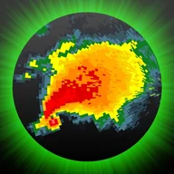
RadarScope shows you what the radar actually sees. Instead of a smoothed rain map, you get single-site radar products such as velocity, updated every two to ten minutes, with NWS warnings and storm tracks on top. That's how spotters find hook echoes and debris signatures. It costs money upfront and assumes you know what you're looking at, but nothing on a phone beats it for severe weather.
Full RadarScope review Zoom Earth
- Live satellite view is mesmerizing and useful
- Clear hurricane tracking for anyone
- Works on the web as well as phones
- Ads in the free version
- 10-day forecast maps need Pro
- Shares some data for advertising
Zoom Earth is the most watchable weather app around. Satellite images from GOES, Himawari and Meteosat refresh every 10 minutes, so you can watch storms spin up in near real time, then switch to radar, wind, rain or heat maps. Its hurricane tracking is clear enough for anyone, and wildfire hot spots come from NASA data. The free version shows ads, and Pro is needed for longer forecast maps.
Full Zoom Earth review